By Ooi Kee Beng, EDITORIAL in Penang Monthly, June 20
DOES THE PENANG Strait separate Seberang Perai from Penang Island or does it connect one to the other?
This question is not as glib as it may sound at first reading. We do think of bodies of water as things that separate the pieces of land on which human beings live. The Atlantic separates Europe from North America; in fact, it kept the existence of each continent a secret from the other until 500 years ago. The same can be said of the Pacific, of course. Asians did not know that there was a continent beyond the Rising Sun, lying at its broadest (between Indonesia and Chile) 19,800km away.
Oceans definitely separate continents, one from the other.
But when the body of water is small, then one can begin to wonder if it connects pieces of land, or separates them. Because of political differences, the 180km-wide Taiwan Strait separates Mainland China from Taiwan. Here, they are separated by politics more than by geography. Had the Chinese Civil War in the late 1940s ended some other way, one can imagine that the Taiwan Strait would be a conjoining stretch of water.
The Mediterranean Sea, throughout history, acted sometimes as the medium that connected cities and civilisations, and sometimes, like present times, as the divider. The Gibraltar Strait, where it is narrowest, measures only 13km, dividing Muslim Morocco from Catholic Spain. Once, when the Moors ruled the Iberian Peninsula (711-1492), that strait had more often than not, functioned as conjoining geography.
The Tiny British Ports
So, it would seem that “function” may be the key term to explore in this context, apart from the width of the waters.
As straits get narrower and narrower, the situation becomes less and less obvious whether they separate or divide. Let’s take the three island ports that the British colonised in this region—Penang, Singapore and Hong Kong.
The British were known for their penchant to occupy little islands that were easy to defend, and that had great strategic value to them. Penang was colonised in 1786, Singapore in 1819 and Hong Kong in 1842.
The trouble with colonising little islands is that, however deep the waters around them may be, a growing population and economy soon needs to be supplied and to be defended. And so the adjacent mainland becomes of great interest.
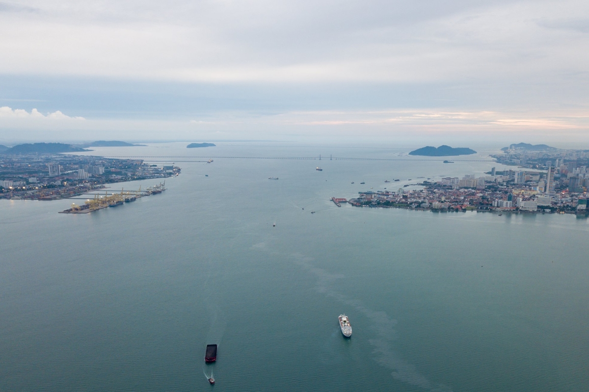
By 1800, the British had attained Province Wellesley (now Seberang Perai) as its security buffer-cum-supplier of various goods for their new island colony. On average, 13kms separate the island from Seberang Perai (the length of the first bridge). At its narrowest point—between George Town and Butterworth—the strait is only 3kms wide.
With a strait that narrow, one would think that the waters would be diligently used as a connecting body between the island and the mainland. But that does not seem to be the case. It is treated like the open sea, good for fishing and for crossing, not for sports or tourism. The Strait of Penang seems to function as a divider, not as the heart of the Penang state. And the two bridges maintain a mindset that sees the strait as a distance to traverse, not an asset to enjoy.
Comparing this to the other two old island colonies at this point can be illuminating. Where Singapore is concerned, we have the Johore Strait (aka Tebrau Strait), which is more or less 1km wide (the length of the Causeway). This is no distance at all. But since it now acts as a national boundary, there is no need to deliberate over its function other than to note that it is a divider. The Causeway and the Tuas bridge also testify to that stretch of water being mere distance to traverse.
Hong Kong then? By 1860, Kowloon had been ceded to it by Qing China, and in 1898, the colony’s size was increased tenfold through the leasing of the New Territories. The integration of these coastlines occurred smoothly in the case of Hong Kong, and the waters are happily used for fervent economic activities, for transport and for leisure.
So, between the case of Hong Kong, where the waters are an asset greedily exploited, and Singapore where the waters are a boundary, we have the case of Penang.
Its potential as an asset is huge, given how little it has been utilised so far. The mindset, perhaps inherited from colonial times, that the waters are a defence or a buffer, is totally outdated. Learning from Hong Kong—and not from Singapore—Penang Strait should be exploited: for its logistical potential as a medium of transport (water taxis or mass transport); to raise the lifestyle and liveability of the state through sports; and as a connector of people, culture and economies.
The initiative undertaken by the Penang State Government to gazette part of the strait (north of the first bridge up towards the mouth of Sungai Pinang) as a marine sanctuary for research and educational purposes is an inspired one that will change how we think of the lovely stretch of water that forms the heart of the state.
[End of Part One]

Discussion
No comments yet.